Sunday, December 30, 2018

Lake Livingston SP, 12/27 - 12/29/2018

69. We drove through the massive thunderstorm that drenched most of Central and East Texas, and snowed mightily on the Midwest and Rockies.  Sea Rim was merely a drizzle compared to the torrential rains in Port Arthur and Beaumont!  On our way to Lake Livingston we saw huge puddles of standing water and began to wonder about the park.  When we got to the Ranger Station, our first question was (joking), "Do you have any dry sites left?"  To which the ranger said, "No."  Uh oh.  So we drove all over the park looking at campsites and finally picked one whose puddles were far enough away from the trailer pad that we could walk around the trailer without needing rain boots!  Since the park was so wet, we decided to spend the afternoon in Livingston, exploring and restocking our groceries.  We walked around the historic town cemetery and wandered through 2 antique shops before driving the Scenic Loop and experiencing the lakeside patio at the Wet Deck bar.  We also checked out the sunset over the lake with the dogs - walked only on the roads since they were relatively dry.  (The park is built for rain - the roads and trailer pads are elevated above the land around them and there is a network of drain tunnels throughout the park that we saw filled with running water the whole time we were there.)
Friday we decided to take our chances with the trails.  The Boardwalk trail was mostly dry, with the exception of the 2 spots where it intersected with the Equestrian trail.  The Oak Flat trail was a wet mess and 2 rangers were busy chainsawing up a pine tree that had uprooted itself across the trail in the storms Wednesday night. 
We built a lovely camp fire and burned all of our wood before dinner - sort of planned it that way as it was getting chilly quickly.  We ended up eating locally-renowned burgers at the Wet Deck for dinner, which really hit the spot. 

Soggy Oak Flat trail.

Entrance sign.

Scampsite #82.

Bulkhead at sunset, park store and observation tower.

Panorama from the Observation Tower.

Great Blue Heron at sunset. 

Lake Livingston SP is near Livingston, which is the county seat.  The courthouse is nice, the town is bustling.  Wet Deck has great burgers and an average beer selection. 


Sea Rim SP, 12/24 - 12/27/2018

Scampsite #3.  We took the ferry from Galveston Island to Bolivar Peninsula - the longest way possible, but the most interesting for sure!  We found out quickly that the mosquitoes hadn't died back yet and LOVED our trailer - our door was away from the wind so they congregated at our door until they could find a way inside - we ended up spraying the inside of the door with bug spray! 
Christmas Day was too foggy in the morning for paddling the trails, so we drove to Sabine Wood, an Audubon site, for some bird-watching - thank goodness we happened to have a  can of bug spray in the truck - the mosquitoes were terrible!  Then we drove to Texas Point National Wildlife Refuge and walked some of the cattle trail there - no mosquitoes, lots of sparrows.  We returned to Sea Rim for lunch and, since the sun came out, a beach walk. 
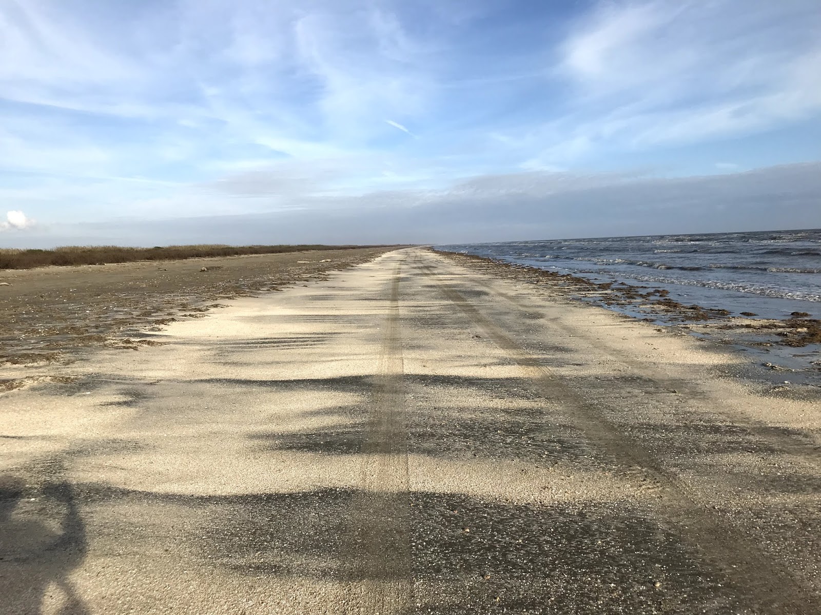
Wednesday morning the boats weren't available to rent because the duck hunters would be out on the flats shooting, so we walked the dogs down the paved road until the end at McFaddin National Wildlife Refuge and walked the beach back to our Scampsite.  Once we got back to our Scampsite, it was obvious that the forecasted storms were on their way, so we spent some time putting things away and getting the trailer ready for departure in the morning, in case it was pouring down rain as forecasted.  Once it started raining, we spent the rest of our time at Sea Rim in our trailer.  Apparently, Sea Rim didn't get much of the storm - probably the sea breezes helped keep it north of the park. 

Sea Rim has a lovely beach that is available for camping - there are no reservations for beach camping, since availability depends on the weather, tides and other conditions that the park rangers assess on a daily basis.  There is also a cabin that looks really nice and a floating platform, built by University of Texas students, for camping in one of the lakes.  The platform is only accessible by boat, is alligator-proof, and requires a bucket-loo for personal needs.
The boardwalk trails that Sea Rim is known for are currently closed - Hurricanes Harvey and Ike damaged them severely and the money to rebuild them hasn't been available at the right times. 

Armadillo at Sabine Wood.

Texas Point NWR view - oil and gas refineries in the distance in Sabine Pass or Port Arthur.

Foggy Christmas morning.

Sunny Christmas afternoon.

Sunny beach on Christmas day. 

Scampsite 3.

Refinery flame, full moon.

Southern boundary of Sea Rim State Park, near McFaddin NWR. 

Big waves from oncoming storms.

Sea Rim is near Sabine Pass and a little further away is Port Arthur.  We didn't spend any time in either town, but both depend heavily on the oil and gas industry.  Sea Rim is pretty remote and we enjoyed that. 

Brazos Bend SP, 12/22 - 12/24/2018

Scampsite #115.  We set up camp, walked the dogs and then walked over to the George Observatory for the Saturday night viewing.  It was a full moon, so the telescopes were focused on whatever else they could see despite the moon.  One of the small ones was focused on Foamalot, which just looked like a white spot.  The biggest telescope was focused on Gamma Andromeda.  That telescope has the 2nd largest elevator in the country in it - the elevator floor carried us up to the telescope, shortest people first.  Local astronomers also bring their personal telescopes to the Saturday night viewings, so we got to see the moon in a personal telescope - it was so bright it took our eyes a few seconds to adjust to the moon's "light"!
Sunday we walked the dogs around Hale Lake - didn't see any alligators, but saw the flood water line on the trees - as high up as my ear!  After we dropped the dogs back at the trailer and had a spot of lunch, the two of us went to the Nature Center - there are local snakes in glass terrariums - I got to pet a hognose snake and we both pet a baby alligator, who chirped at us!  The ranger said he was a rescue and was chirping for his lost mama.  Then we walked along the south side of Elm Lake - saw our first alligator there! We went up the Observation Tower, walked around 40 Acre Lake to the Prairie Trail and then to the Live Oak Trail.  We saw tons of different birds and it was cool walking through the swampy part of the park, then the prairie, then the trees. 

Brazos Bend landscape.

Gator with Snowy Egret.

Brazos Bend landscape.

Gator on the trail.

Live Oak Trail.

Scampsite 115.

George Observatory.

Hale Lake picnic area - notice the dark flood line on the lower parts of all the trees.

Panorama from the Observation Tower. 

Anhinga.

Red-Shouldered Hawk, right next to us on the trail.


Brazos Bend is near Richmond, which is a county seat and has a lovely old, domed courthouse.  There are 2 breweries, one of which is also a winery in Richmond.  We visited Fulbrook Brewery and were impressed with the beer there.  
Alvin is also relatively close, but we didn't explore Alvin at all.  

Sunday, July 15, 2018

Caprock Canyons, 7/9 - 7/11/2018

Scampsite # 12, we had a BISON wander through our site the first evening!!!  Fortunately the dogs were inside the trailer.  Caprock Canyons is home to the Texas state bison herd, which is descended from the original few Southern Plains bison that Charles Goodnight (the rancher and cattle driver for whom the Goodnight Trail is named) saved upon realizing that white folks were exterminating the bison.  Because they've been isolated from other bison herds, these are among the last of the Southern Plains bison in the country. 
Caprock Canyons is an amazing park.  There are TONS of trails, easily accessible from the campgrounds and it's close to the 62-mile dirt Trailway (although the Trailway is NOT accessible from within the park).  Summer temperatures get over 100 easily, so we were warned to be back at camp by 2:00 at the latest and to carry 1 gallon of water per person and 1 gallon of water per animal.  We hiked the Wild Horse and Mesa Trails, both of which were lovely and perfectly challenging. There was even a remnant "pond" of water in the Little Red River near the windmill!
Lake Theo is in the middle of the park too - folks fish and boat there and can camp right next to the water, but the bison like the lake too.
There is also rough, dirt County Road 29, most of which goes through the eastern edge of the park, and which was tons of fun to drive.  4x4 vehicles strongly recommended for that one. 
There is a prairie dog colony near the Honey Flat camping area, but we didn't see any Burrowing Owls. 
Scampsite #12.

Prairie Dog.

Early morning view of the canyon.

Bison near the trail.

Bison at the bottom of the canyon, center left.

Dung Beetles take care of the immense amounts of bison poop.

The remnant "pond" along the trail.

Equestrian camping area.

Folsom site near Lake Theo.

The bison herd, or at least the cows and calves.

Our visitor.

4x4 County Road 29.

County Road 29, near and far. 

The pond by County Road 29.

Ha ha we love it when state parks have humor! 

More humor I think....Not sure I'd want to camp in the Overflow area...

Caprock Canyons is sort of midway between Lubbock and Amarillo, but not really close to either one.  

Friday, June 29, 2018

Cleburne State Park, 6/26 - 6/28/18

65. Scampsite #38, Tuesday through Thursday.  We actually started out in the Poplar Point area, site #46, but it became obvious that "our" site was THE path to the lake.  This was not the kind of Scamping experience we wanted, so we scoped out the other camping areas, found a site in the North Creek area that we liked and a ranger who was willing to let us move!  Site 38 was 2 spots away from the Park Host, who told us she would be gone the next morning, and the next closest RV was several spots away.  It turned into exactly the kind of Scamping experience we wanted!
Wednesday morning we decided to hike the perimeter trail and to the old CCC bridge.  The trails were challenging - hillier than we anticipated - and FULL of poison ivy.  SO MUCH POISON IVY!  We had to keep the dogs on short leashes so that they wouldn't walk in it and give it to us.   The old CCC bridge is gorgeous - it's a footbridge now - and it's also the logo of the park, which is pretty cool.  The "charming" (according to the state parks guide) 3-tier dam was also quite impressive.  We noticed that the wildlife - squirrels and cardinals - were especially unafraid of us.  While we were loading our Camelbaks with our lunches, one squirrel was actively begging at our feet for our bags of chips! The cardinal perched on our trailer step within minutes of our arrival.

Scampsite 38.

Scampsite 38.

Begging squirrel!

Fearless cardinal!

The "charming" 3-tier dam built by the CCC.

Bridge built by the CCC, also the park logo. 

Detail of the bridge construction.

Scampsite 38 from the road. 

Cleburne State Park is close to Cleburne, which is the county seat.  The courthouse is beautiful, the town has numerous antique shops, and it's on the Amtrak rail line.