Sunday, October 8, 2017

Fanthorp Inn State Historic Site, 10/7/17

53. This is a day-use only site, so we had to get creative!  The Inn was lovely, our tour guide was a Park ranger named Adam, who knew tons about the Inn's history.  Since the Inn was going to be difficult for us to visit in anything other than a camping trip, and there aren't any state parks with camping nearby, we discovered Gibbons Creek Reservoir, which is the reservoir that cools the coal-fired power plant that serves several municipalities in Texas, including Bryan.


Rainwater collection to the cistern.

Dining room for the Inn.  Notice the fans, also known as "Shoo-Flies".  

Room refurbished as if Sam Houston, the Inn's most famous guest, was staying there.

The cheap quarters.  There were 3 of these beds, plus the pallet on the floor.  3 adults, 4 if at least one body was a child, slept in one bed, along with all their bugs, weird habits, and diseases.

The Inn, from the picnic tables.

Tack for the mules who pull the stagecoach, Waylon and Willie. 

The Inn was located at the junction of 5 different stage lines, so they have a replica stagecoach.  Once a month, the Inn takes visitors on rides to town (Anderson) on the stagecoach. 

After our visit to the Inn, we proceeded to explore Bryan and College Station a little bit, notably the breweries.  Coincidentally, we picked the day of the Texas A&M vs. Alabama (currently ranked #1) football game, so town was a bit busy.  


New Republic Brewing, College Station.


We explored some dirt roads (190 & 192) and found Gibbons Creek!  The crossing is blocked off because the bridge has holes in it, but the creek is very pretty and apparently floods occasionally. 


Gibbons Creek and bridge. 

Gibbons Creek bridge. 


The coal-fired plant at the Reservoir used coal that was mined locally.  These mines haven't been used in years and the land is being monitored for contamination.  Theoretically, the lands will all be put on the market in 2020.

Our campsite, #9, at Gibbons Creek Reservoir.  

Gibbons Creek Reservoir.   The road to the campground goes on top of the dam. 

Gibbons Creek signage.

The power plant at sunset.  
Currently, it's not in use and is for sale.  Ideally, the plant and the reservoir would be sold privately as opposed to being decommissioned and draining the lake.  This is all due to the fact that solar, wind energy, and natural gas (of which Texas has a lot) are cheaper and less pollutive than coal-fired power plants.  

Other things to see and do in the area: Bryan has a brewery as well: Blackwater Draw and has a brewpub.  We tried to get BBQ from Fargo Pit BBQ, which was one of Texas Monthly's recent top 50 BBQ Joints, but being a huge game day, they sold out by 1:30!  Another time....
In the same warehouse-y area as New Republic Brewing was a distillery and winery (Perrines) and Messina Hof is also located in Bryan.  
Anything Texas A&M offers to the public will be interesting: football, vet school open house, etc. 
The Brazos County Courthouse has all new windows and looks better than it did when we first saw it, when some of the windows were covered with plywood, but it's still an ugly building. The old downtown part of Bryan is really cute and has great potential.  
Anderson, where Fanthorp Inn is located, is a sleepy little town, but it does have a cute courthouse and good antique shops.  Washington-On-The-Brazos isn't too far from Anderson also.


Sunday, April 16, 2017

Colorado Bend State Park, 4/15/17

51. Colorado Bend is a gorgeous little park in the bend of the Colorado River.  There are tent sites right on the river, in the canyon, but the gem of the park is Gorman Falls.  We opted not to camp but to hike to the falls instead.  We plan to return in the dog days of summer to enjoy the river part of the park as well.

Gorman Falls trail

Gorman Falls, first glimpse

Gorman Falls

Gorman Falls

Black-throated Sparrow (I just think this is a lovely picture of a beautiful little bird and he had the loveliest song too)

Wildflowers along the Gorman Falls trail

View of Colorado River from the Tie Slide Overlook

Gorman Falls on the Colorado River

Gorman Falls on the Colorado River

Colorado Bend is nearest to Lampasas, which is the county seat of Lampasas County.  The courthouse is a stunning one, located just east of highway 183.  There are antique shops, restaurants, and a beautiful park at Hancock Springs.

Saturday, March 25, 2017

Franklin Mountains State Park, 3/16/2017

50. We initially had reserved a Scampsite here, but upon further research, and after our micro-managed experience at Hueco Tanks, we cancelled our camping reservation and got a hotel room instead.  The RV "sites" are just parking spaces in a lot, with a couple of picnic tables nearby.  We knew there wasn't any water or electricity, but there wasn't even a composting toilet nearby!  And, we would have been schlepping the dogs around with us in the truck while we did other things in El Paso, so we decided that air-conditioning for the dogs and proximal restroom facilities were more important than camping in a parking lot.  
However, we did do the biggest hike Franklin Mountains has to offer and it was amazing: North Franklin Peak.  It was almost 8 miles up and back, and about 2000 feet up in elevation.  The trail is about half big rocks, half gravel.  The big (melon-sized) rocks made for challenging hiking mentally, as we had to focus on where we were putting our feet so as to not turn an ankle.  The hike was just as exhausting mentally as it was physically.  The views along the way are spectacular and we did see some cool birds, including Eastern Bluebirds!  If you do this hike, start EARLY (before 9 a.m. would be ideal), bring lots more water than you think you'll need, snacks, and hiking poles.  And don't forget the sunscreen - there is no shade on any of these trails.  (If you bring dogs, bring water and snacks for them too.)

We started at the You Are Here, took the West Cottonwood Springs trail to Mundy's Gap trail, to the North Franklin Mountain trail.  

View of the west side of the mountains from a little ways up.  You can see the parking lot at the center right.

East side of the mountains, Gordie is interested. 

Aaron and Lulu at the Danger sign.  This is close to the boundary between Franklin Mountains State Park and Ft. Bliss.

Once upon a time, people drove to the top of the mountain.  This car didn't make it; looks like it rolled down.

Contrail shadows.

The last (gasp!) hill up to the top! 

The HAM radio tower at the top.  My dad, a retired geology professor at UTEP, said the Knapp brothers wanted to develop the top of the mountain, so had a bulldozer scrape off 5-10 feet of the peak to create the flat area.  The Knapps also operated the HAM radio and may have been responsible for the rolled car in a previous picture. 
I found an interesting timeline of Franklin Mountains history, particularly 1978-1979:
https://franklinmountains.files.wordpress.com/2015/11/1c-historical-timeline-for-castner_final-july-2015-final.pdf

Franklin Mountains State Park is in the middle of El Paso, which is the farthest western point in Texas.  El Paso is also the location of the end of the Rocky Mountains, a county seat, and home to the University of Texas at El Paso (UTEP).  The UTEP campus is built in the architectural style of Bhutanese monasteries and is one of the most energy-efficient university campuses in the US.  Juarez, Mexico, is safe to visit again, and El Paso has a burgeoning craft beer scene that is pretty good.  There are tons of things to do in El Paso, I highly recommend stopping and staying a while (and not just because it's my hometown :-).


Hueco Tanks State Park & Historic Site, 3/13 - 3/15/2017

49. We camped at Scampsite #8.  This park is amazing because of its unique rock art that dates back about 10,000 years, and because of its interesting boulder formations.  However, it was probably our most disappointing state park experience because of the bureaucracy.  
First, we had to watch a 15 minute video about the history of the park, including the horrific graffiti vandalism that has been added over the years.  That was expected and not a problem.  We had the dogs with us though, and because state law says it's illegal to leave pets in a car, the park rangers told us to bring them in to watch the movie too (the dogs said it was boring, not enough animal action).
We were informed of the rules of the park as well, including the 6 p.m. curfew.  Yes, all campers MUST be in the campsite by 6 p.m. and STAY there until 8 a.m.  They did give us the gate code in case of emergency, but we've never experienced the curfew at a state park.
Hueco Tanks isn't hospitable for dogs: the only place we could walk them was the road.  Because of the rock art, dogs aren't allowed on any of the trails in the park.  They can't be left alone at the campsite either unless you have a trailer / RV with air-conditioning.
And actually, people are restricted as well: North Mountain is open to the public, but you have to have a reservation because there is a 70-person limit.  East and West Mountain are only accessible with a ranger or guide.  So when I made the park reservation weeks ago, I was able to reserve our access to North Mountain as well, as long as we "claimed" it before 10 a.m. on the 14th.  So we went to the office at 9:30 to "claim" our reservation and were told that there was already a line of cars outside the gate and that we would have to wait and see how many of them had reservations, despite us having been camping in the park and already having a reservation ourselves. We were able to "claim" our reservation at 10, but it was frustrating that invisible (to us) cars had been given priority over campers who had a reservation already.
We were only able to hike and leave the dogs in the site because we have a trailer with air-conditioning that we could safely leave the dogs in while we were on the trail.

Once we got hiking, all worries melted away.  A ranger had recommended the Cave Kiva trail, so we traded Aaron's driver's license for a map of that trail and were able to find the rock art that is used as the Hueco Tanks logo, and in my opinion, is probably the best rock art in the park.  It's located inside a "cave" - not a cave like you imagine, but huge boulders fitted together that create a large open space underneath - so it's protected from the elements; the colors are vibrant and clear.   I suspect it doesn't get a lot of visitation because it's a little difficult to find, even with a map; the trail isn't marked at all.  And from that vantage point, we could also see a pond below that we were later told was the only standing water in the park.  That is pretty remarkable because Hueco Tanks is in the high desert; there is probably no other standing water for at least 50 miles in any direction.   So, we felt like we saw the best rock art and the best scenery in the park and weren't disappointed that the guided tours were all filled up already.

I would recommend Hueco Tanks, but not during a busy spell, as it turned out Spring Break was.  We have been there before as a day trip in the middle of summer (hiking ended by noon), and it was much more relaxed - although the rules all still applied, there just weren't as many people for the rangers to worry about and we didn't have dogs with us that day.  

Even on our way out of the park, the rangers still had to exert authority - Aaron talked to a ranger outside the park office as we were leaving and he said we were good to go.  Then at the main gate (a ways down the road), we were stopped and told that we hadn't checked out.   Apparently the ranger Aaron talked to didn't inform the rangers inside the office that we had talked to him.  GRRRR....
I understand that people are idiots, people have died at Hueco Tanks, and people like to leave their own mark.  The desert is tough, even on natives, and it's very easy to forget sunscreen or enough water or enough snacks.   But we felt there has to be a better way to police the idiots and still let law-abiding citizens have a good time without feeling parented.

Scampsite 8, sunrise.  The picnic table is located in the trees behind the trailer - very private and lovely. There was a Verdin nest and a very angry Verdin in our site too! 

The pond from the Cave Kiva "trail".

The "cave" where the best rock art is located.

Hueco Tanks logo art.  Inside Cave Kiva. 

Us, inside Cave Kiva, with some art.

The "trail" going down, Aaron ahead of me.

The pond. There were LOTS of little birds here: House Finches, Lesser Goldfinches, White-Crowned Sparrows.  

Hueco Tanks is about 30 miles outside of El Paso, which is the farthest western point in Texas.  El Paso is also the location of the end of the Rocky Mountains, a county seat, and home to the University of Texas at El Paso (UTEP).  The UTEP campus is built in the architectural style of Bhutanese monasteries and is one of the most energy-efficient university campuses in the US.  Juarez, Mexico, is safe to visit again, and El Paso has a burgeoning craft beer scene that is pretty good.  There are tons of things to do in El Paso, I highly recommend stopping and staying a while (and not just because it's my hometown :-).

Monday, January 2, 2017

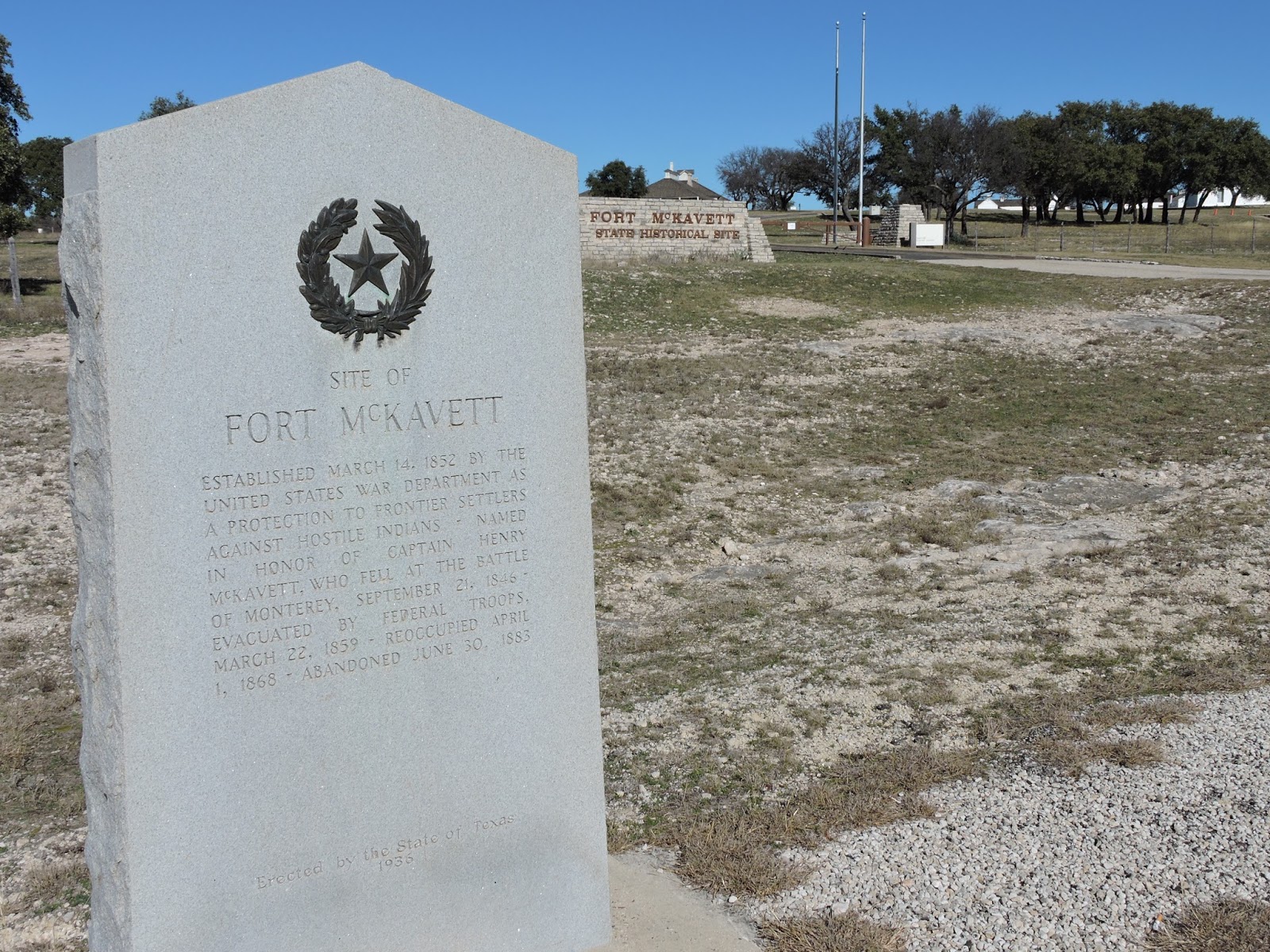
Fort McKavett State Historic Site, 1/1/17

There is no camping at Ft. McKavett, so this is a day trip, but we planned our route home to include it.  And then discovered that it was closed!  Oh well,  it had the same functions, and many of the same buildings (although different design, age, and upkeep) as Ft. Davis did.  And, technically, it's not part of the State Parks system; it's part of the Texas Historical Commission.

Signage about the Fort.  

Ruins.

Barracks at the fort. 

Nearby adventures: Presidio de San Saba in Menard, which is also a county seat.  Menard has a "Ditch Walk" along the irrigation ditches, restaurants, motels, etc.  It is the county seat, so has a courthouse with a pool at the end of the lot, as well as a cute depot.

Seminole Canyon State Park and Historic Site, 12/27 - 12/29/16

47. Scampsite 12E (for electric); we set up and then hustled back to the Ranger Station for the afternoon tour of the Fate Bell Shelter, which is a ranger-led tour.  VERY COOL.  We highly recommend any ranger-led tour here; one can't access the pictographs without one.  We hiked the Rio Grande Trail and then took the Canyon Rim Trail back - it started out as a cool, misty, foggy day, but warmed up noticeably by the time we had left the Panther Cave overlook.  Those trails were great, but a little much for our pups!
This park has a lot of campsites and is easily accessible.  There is a group of campsites that look unfinished; when Aaron asked the ranger about them, she confirmed that the park ran out of money after they put in all the conduit, but before they could finish.  Hopefully they will finish those sooner than later.
There were frequent drive-throughs by the US Border Patrol too, which we found very interesting.

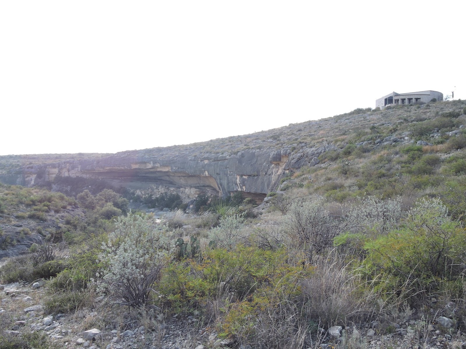
View of the Ranger office above the Seminole Canyon floor. 

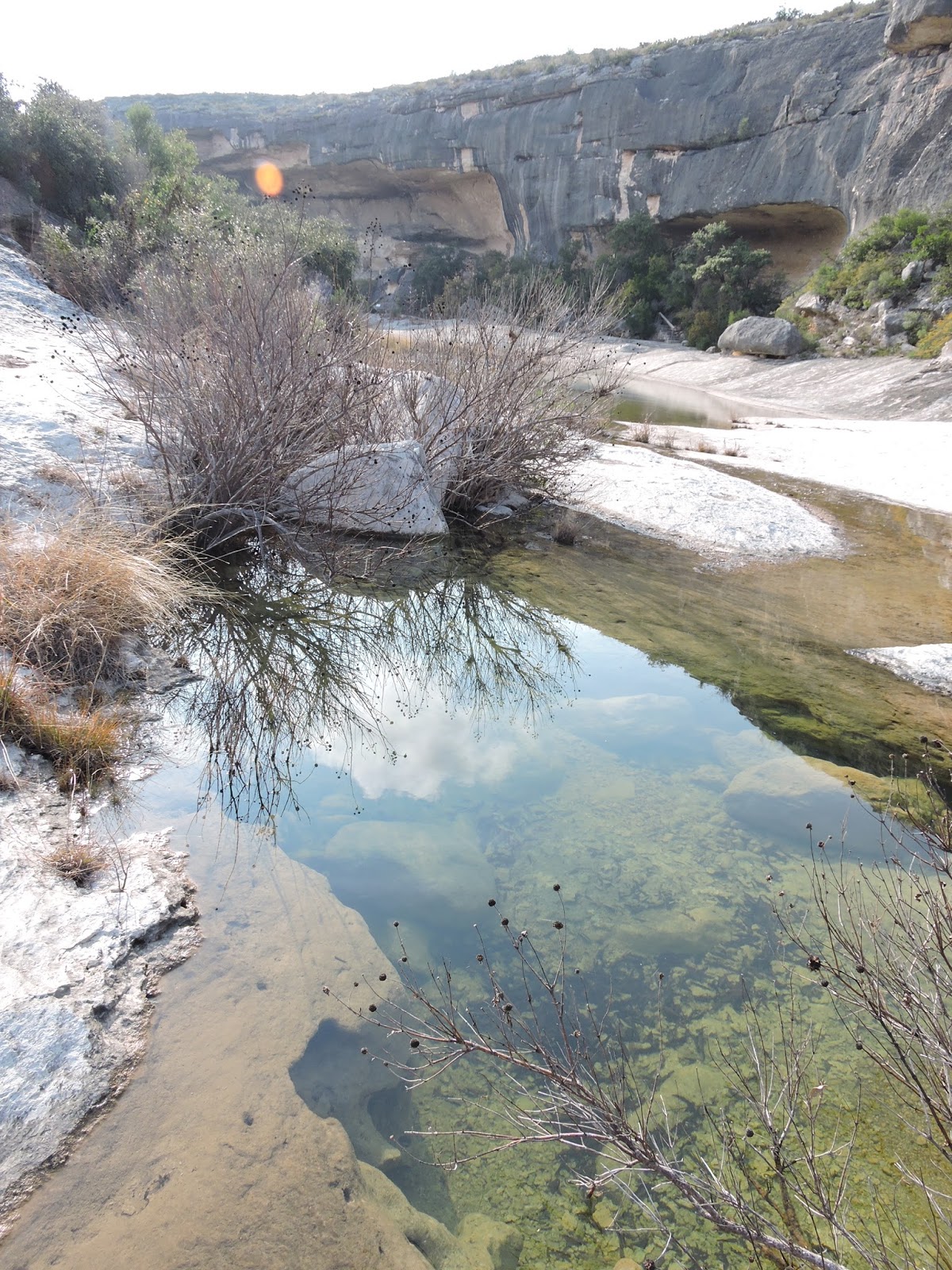
Seminole Canyon - there is water from recent rains, there is no river flowing through here.

Fate Bell Annex.

Fate Bell Annex clarification sign. 

View of the Rio Grande from the Rio Grande Trail.

View of Panther Cave from the Canyon Rim Trail.  This is accessible only by boat.

Seminole Canyon meets the Rio Grande. 

Clarification sign for Panther Cave.

Gordie and Lulu on the Canyon Rim Trail. 

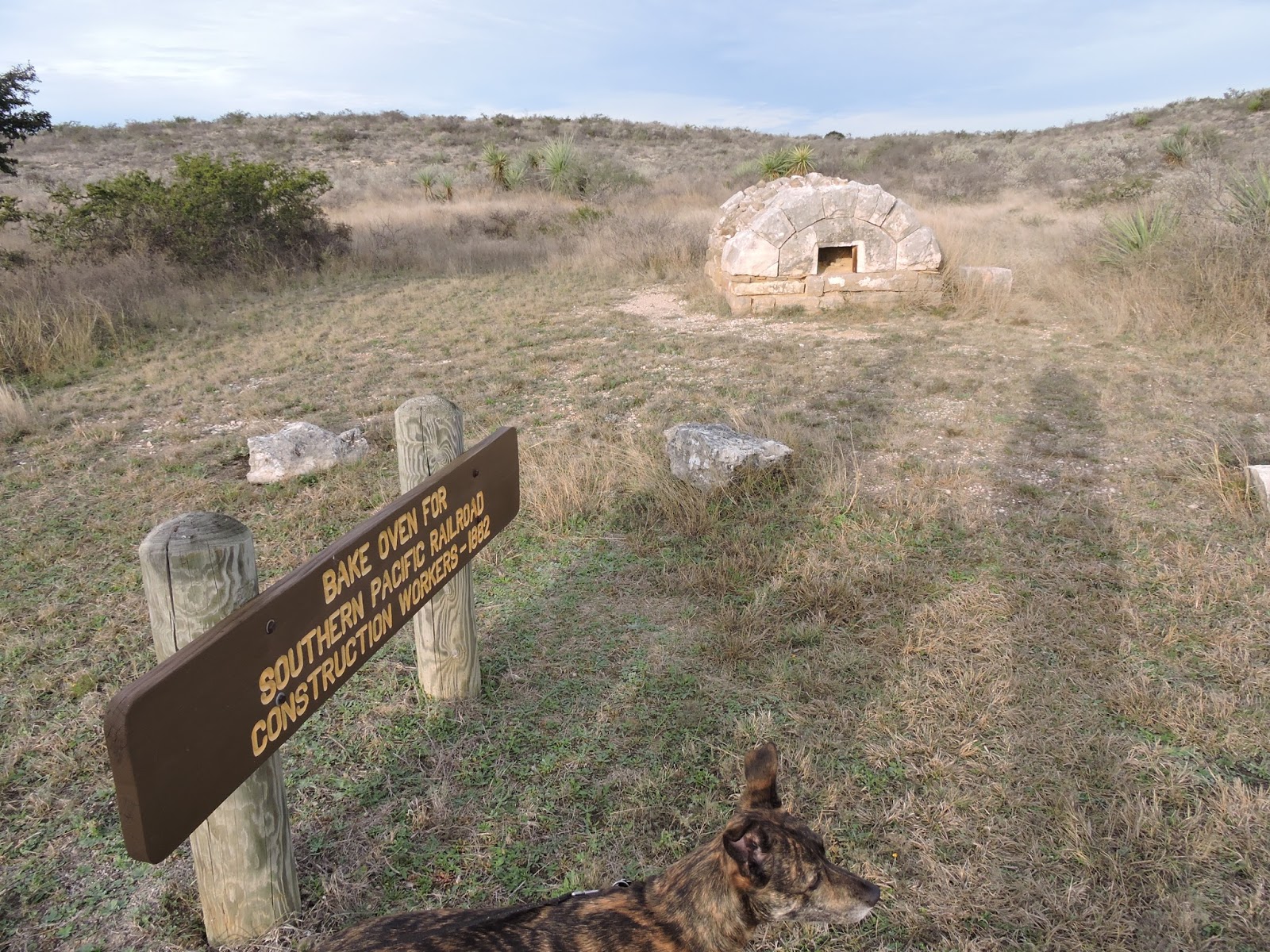
The railroad once went this way, before bridge technology improved so that they could go over the canyons instead of around them. 

Scampsite 12E, with a little sunset. 

Nearby attractions: the bridge crossing the Pecos River, west of Seminole Canyon, is spectacular.  Del Rio is the nearest county seat; it has lots of RV parks, restaurants, groceries, movies, bowling, and a lovely 3-mile (roughly) walking path along the San Felipe Creek.  We walked the dogs there twice and thoroughly enjoyed it both times.  It's located between the Lions Park and the Country Club.  Val Verde Winery is also Texas' oldest winery, and the drive to it is gorgeous.