Monday, January 2, 2017

Fort McKavett State Historic Site, 1/1/17

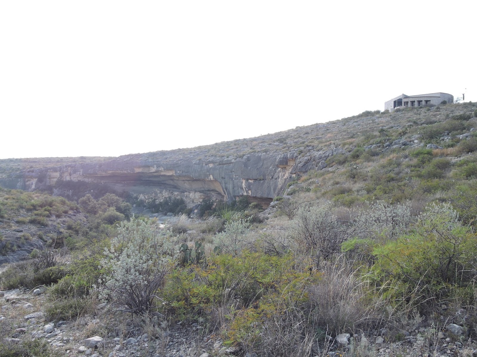
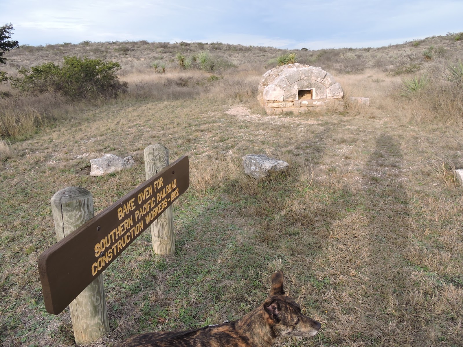
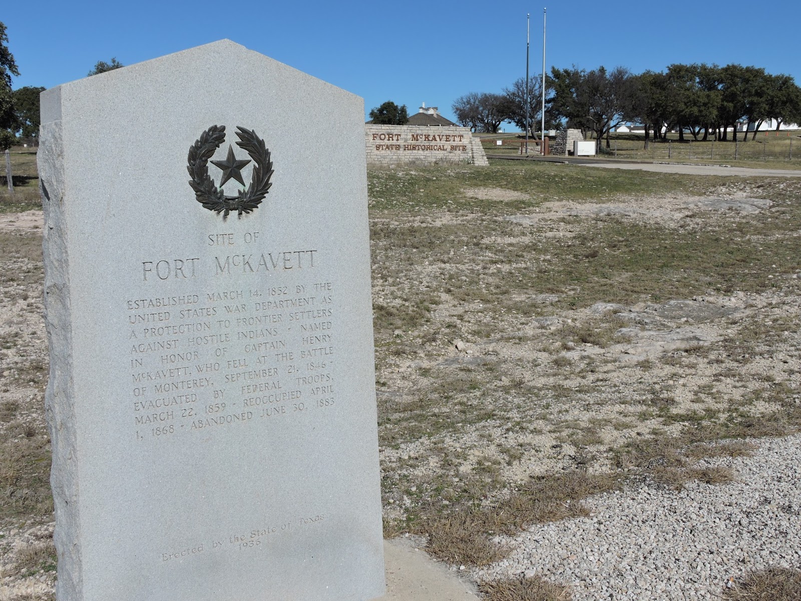
There is no camping at Ft. McKavett, so this is a day trip, but we planned our route home to include it.  And then discovered that it was closed!  Oh well,  it had the same functions, and many of the same buildings (although different design, age, and upkeep) as Ft. Davis did.  And, technically, it's not part of the State Parks system; it's part of the Texas Historical Commission.

Signage about the Fort.  

Ruins.

Barracks at the fort. 

Nearby adventures: Presidio de San Saba in Menard, which is also a county seat.  Menard has a "Ditch Walk" along the irrigation ditches, restaurants, motels, etc.  It is the county seat, so has a courthouse with a pool at the end of the lot, as well as a cute depot.

Seminole Canyon State Park and Historic Site, 12/27 - 12/29/16

47. Scampsite 12E (for electric); we set up and then hustled back to the Ranger Station for the afternoon tour of the Fate Bell Shelter, which is a ranger-led tour.  VERY COOL.  We highly recommend any ranger-led tour here; one can't access the pictographs without one.  We hiked the Rio Grande Trail and then took the Canyon Rim Trail back - it started out as a cool, misty, foggy day, but warmed up noticeably by the time we had left the Panther Cave overlook.  Those trails were great, but a little much for our pups!
This park has a lot of campsites and is easily accessible.  There is a group of campsites that look unfinished; when Aaron asked the ranger about them, she confirmed that the park ran out of money after they put in all the conduit, but before they could finish.  Hopefully they will finish those sooner than later.
There were frequent drive-throughs by the US Border Patrol too, which we found very interesting.

View of the Ranger office above the Seminole Canyon floor. 

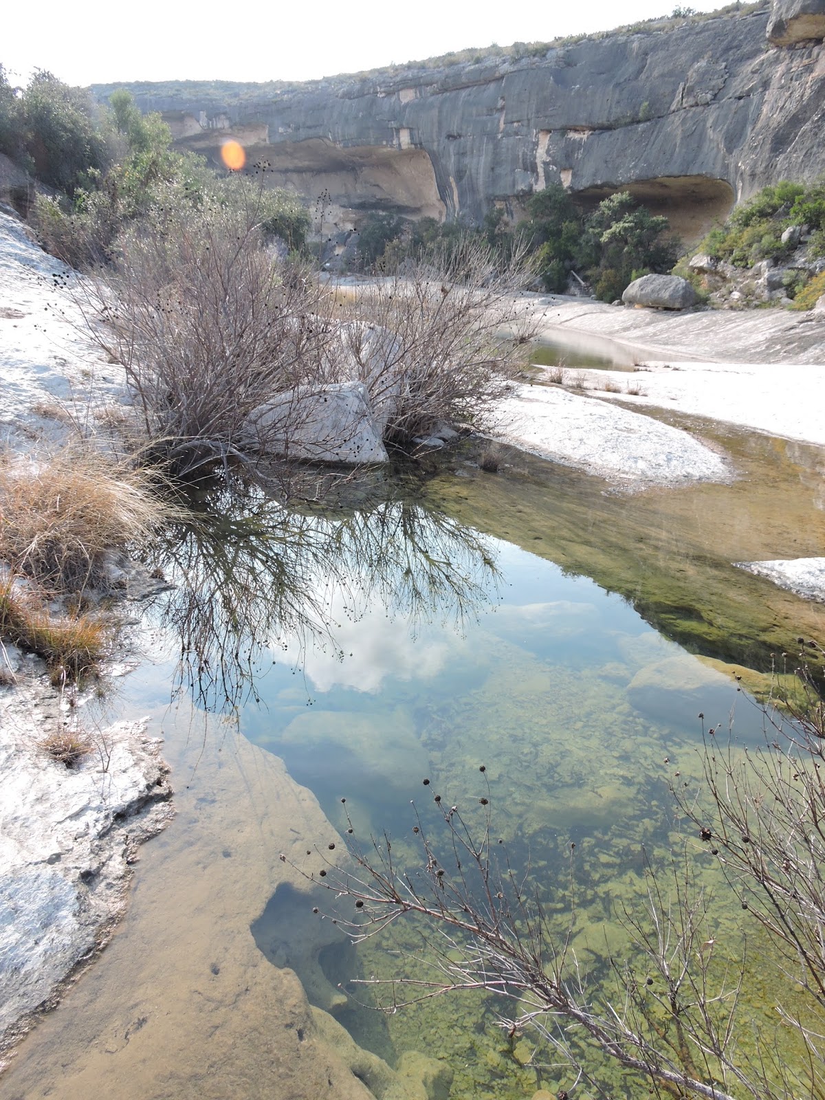
Seminole Canyon - there is water from recent rains, there is no river flowing through here.

Fate Bell Annex.

Fate Bell Annex clarification sign. 

View of the Rio Grande from the Rio Grande Trail.

View of Panther Cave from the Canyon Rim Trail.  This is accessible only by boat.

Seminole Canyon meets the Rio Grande. 

Clarification sign for Panther Cave.

Gordie and Lulu on the Canyon Rim Trail. 

The railroad once went this way, before bridge technology improved so that they could go over the canyons instead of around them. 

Scampsite 12E, with a little sunset. 

Nearby attractions: the bridge crossing the Pecos River, west of Seminole Canyon, is spectacular.  Del Rio is the nearest county seat; it has lots of RV parks, restaurants, groceries, movies, bowling, and a lovely 3-mile (roughly) walking path along the San Felipe Creek.  We walked the dogs there twice and thoroughly enjoyed it both times.  It's located between the Lions Park and the Country Club.  Val Verde Winery is also Texas' oldest winery, and the drive to it is gorgeous. 
Devils River State Natural Area, 12/26/16

46. Devils River SNA has campsites, but we were leery of taking our little Scamp down the dirt road to the park - turns out we were right!  It would have had a hard time getting to a campsite in the park, so we got a spot at an RV park on the edge of Del Rio and made this one a day trip.  We talked to the Ranger at the office and he gave us hiking suggestions: there is a 12 mile loop (which seemed a lot to ask of our dogs) and a shorter road to the river.  He recommended walking to the river, checking out Finnegan Springs, and then doing the loop just to the top of the first hill and back again.  So we did exactly that.  There are signs in the park that give WAY more information about paddling the park than is available on the website; someday we'd like to return and do a little paddling there.  The campsites are lovely, this is a VERY remote park, but there is a bunkhouse available that sleeps 10.  It looked like they might be building a second bunkhouse too.
If you go, make sure you have a high-clearance vehicle (and trailer), and the recommended tires and supplies.  There is no go-back-to-town to get stuff - town is at least an hour's drive away, and cell service is non-existent as well.  The Ranger office doesn't even have a cardswiper and there are no toilets at the campsites!

Road to the river, composting toilet at river.

Hiking trail map.  Note that only 4.76 miles of the trail is actual trail - the rest is dirt road.  Bring 2 vehicles and shuttle?

Paddling map.  Very helpful.  

Devils River.

Hike up to the top of the hill.  Look for rock cairns. 

An absurd trail marker.  Made us laugh! 

View from the top - that's the river way out there. 

Our Scampsite at Lonesome Dove RV Park.

Nearby Devils River SNA: Del Rio.  It has lots of RV parks, restaurants, groceries, movies, bowling, and a lovely 3-mile (roughly) walking path along the San Felipe Creek.  We walked the dogs there twice and thoroughly enjoyed it both times.  It's located between the Lions Park and the Country Club.  Val Verde Winery is also Texas' oldest winery, and the drive to it is gorgeous. 
Lake Amistad is part of the National Park system, and is an international reservoir.  There is camping available there too, but not much more "luxurious" than Devils River would have been.  Definitely not as nice as most other Texas State Parks.  Probably easier access for our Scamp than Devils River would have been.  

Kickapoo Cavern State Park, 12/23/16 - 12/15/16

45. We are the ONLY campers in the whole park (other than the Camp Host, Don) - highly unusual apparently.  (I'm still not sure if it's unusual that we were there or that we were the only ones.)
Scampsite #7; despite the misty, chilly drizzle, we hiked the Long Way Home Trail, about 7 miles.  It was mostly flat and beautiful.  This park used to be a working sheep and goat ranch, so the Ranger's house is the old ranch house, which we passed on our hike.  And we think we saw a coyote running outside the old ranch house.  We also hiked the Seargeant Memorial Trail to the top of the hill.  The Cavern tour was not available, seeing as how we were the only folks there, so we are saving the rest of the hikes for when we go back to see the caves for which the park was named.   This is a lovely park, with just a handful of campsites.  It's pretty remote and neither of us had any cell service (AT&T and Verizon).

Scampsite 7.

Long Way Home trail - notice the water tank on the right.

Kickapoo history.

Water tanks, windmill.
View from the top of the hill, Seargeant Memorial trail.

Merry Christmas! 

Sunset from the Scamp.

Nearby Kickapoo Caverns: Brackettville is the closest county seat, Rocksprings is just a little further. Both towns have gas, groceries, and cute courthouses.  Rocksprings has the Historic Rocksprings Hotel, if your campsite gets rained out!  Devils Sinkhole SNA is nearby as well; it would be relatively easy to add that to this trip, if you were there when the bats are visiting.

Sunday, December 18, 2016

Monument Hill and Kreische Brewery, 12/17/2016

44. We visited this park for its Trail of Lights, since that is something unique to this park and it's very pretty as well.  Monument Hill is the actual tomb of 56 US soldiers who were killed by Mexican troops in Texas' War of Independence - 36 from Dawson's Massacre, 16 from the Black Bean Lottery.  

This event was actually the reason for our initial visit to La Grange in 2010, during which we decided, while gazing upon the Fayette County Courthouse, to visit all 254 County Courthouses in Texas.  It was the beginning of the end.  And I didn't realize that our visits were EXACTLY 6 years apart (12/17 2010 & 2016) until I uploaded the older photos here.  ðŸ˜€

Fayette County Courthouse, La Grange, 12/17/10

Kreische house, 2010

View from Monument Hill & Kreische Brewery, 2010

Kreische Brewery ruins, 2010

Kreische Brewery sign, 2010

Us, 12/17/2010

Us, Fayette County Courthouse, 12/17/16

Trail of Lights, 2016

Kreische house, Trail of Lights, 2016

Guitarist, Kreische House, 2016

The Monument and tomb, 2016

Trail of Lights, 2016

Tile mural of the Black Bean Lottery, 2016

Trail of Lights, 2016

2016

La Grange is a cool town - there is a lovely restaurant, Bistro 108, where we ate dinner both years.  The cemetery has some of the most fantastic stone monuments in it - we haven't seen another cemetery that compares.  La Grange had a highly skilled stonemason at one point and it shows.  Weikel's Bakery is always worth a stop - in addition to wonderful kolaches (and my favorite, the Czech shortbread), it has clean restrooms and a nice gift shop.  The Courthouse is gorgeous inside and is unique among Texas courthouses in its design.  The old jail is now a museum, but has the cells inside still, so one can pretend they're locked up!

Monday, November 21, 2016

Government Canyon State Natural Area, 11/21/16

43. We brought our parents here for a day trip while Mom and Dad were visiting from Colorado.  We hiked the Joe Johnston trail to the dinosaur tracks and then Aaron and I also hiked the Canyon Overlook trail just to where we could see the tracks from above.  It was a lovely trail, not a lot of elevation change, some smooth flat areas, some rather rocky parts.  The dinosaur tracks were under water, so that made it harder to see them, but the view from the Overlook was pretty good.

Government Canyon is on the northwest side of San Antonio, so not close to the courthouse or Riverwalk, but we did stop at Freetail Brewing on the way home for beers and an early dinner.

Aaron at the top of the canyon.

Government Canyon Creek.

Dinosaur tracks.

Sign about the tracks.

Government Canyon Creek from above.